Near Space Labs Surveys for Claims
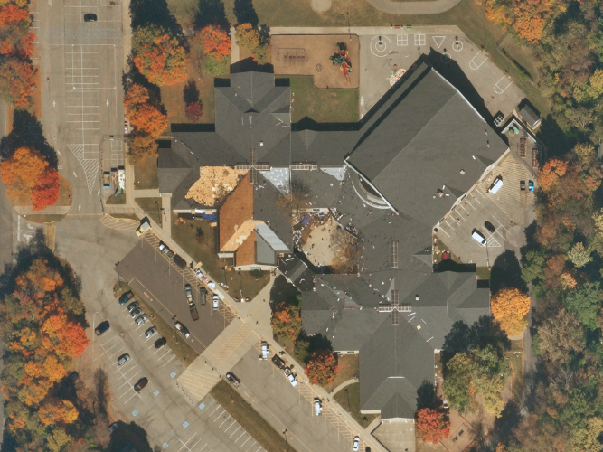
Quickly validate claims and assess damage at scale with time sensitive, high resolution image Surveys, for more confident, accurate and effective claims management”.
Make Faster, Smarter, and More Accurate Claims Decisions
Why Near Space Labs?
- -Our zero-emission vehicles fly in the stratosphere, giving us a unique advantage in capturing ultra high-resolution property imagery at scale. Our vehicles fly twice as high as commercial airlines, enabling us to deliver timely and accurate data with no tradeoffs.
- -Our technology is fast and flexible, allowing us to capture data within 24 hours after a catastrophe and deliver fully processed imagery within 48 hours of an event. This significantly enhances catastrophe preparation and response plans, giving claims teams the information they need to respond quickly and effectively in the aftermath of a disaster.
- -In addition, we revisit high risk areas before, immediately after, and 40 days after a catastrophe, providing accurate baseline data to help reduce fraud and speed up the claims process. With our technology, claims teams can access the data they need to make informed decisions, helping to ensure that claims are processed quickly and accurately.

Enhance Catastrophe Preparation and Response Plans
Near Space Labs is a company that offers insurance companies three types of Surveys to help reduce losses from secondary perils and assist policyholders with recovering quickly. These Surveys are designed to provide carriers with pre- and post-claim sources of truth, allowing them to more quickly assess damage and minimize the impact of severe weather events. By utilizing Near Space Labs' imagery, carriers can build a more accurate picture of events and provide better assistance to policyholders. Don't miss out on the opportunity to enhance your claims processes with Near Space Labs' Survey programs.
.

Pre-Season
Preemptive capture of large scale, high risk exposure locations.

Rapid Post-Cat
Captured within 24 hrs of a catastrophic event, delivered orthorectified within 48 hrs.

PostCAT40
Recapture of locations that filed claims, for proof of status and evidence of pre-existing damages.
Stop Wasting Time and Resources.
Expedite the Claims Process Today.

Wide-Scale Captures
Achieve full coverage of large metropolitan areas, suburbs, and rural locations with our ability to capture entire cities in a matter of hours

Time Sensitive
Highest Quality Orthorectified data delivered within 48 hours of a severe weather event

High-Resolution
See detailed views and conditions of properties with ultra high-resolution imagery.
.png?width=100&name=globe%20(2).png)
Zero-Emissions
Achieve ESG goals by incorporating our sustainable Earth Imaging solution
